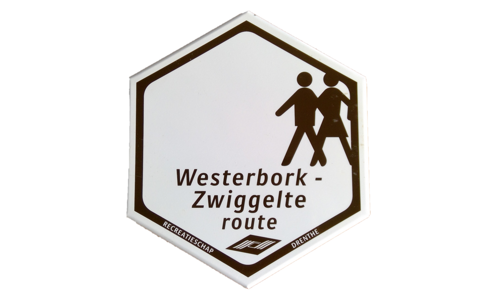
Westerbork-Zwiggelte

(15.0 km)

  • Download
  • First mentioned in ancient writings in 1206, Westerbork is the departure point of this signp…

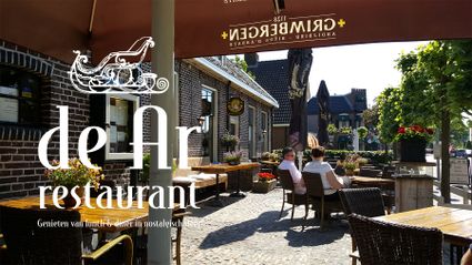
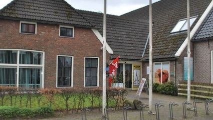
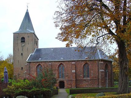
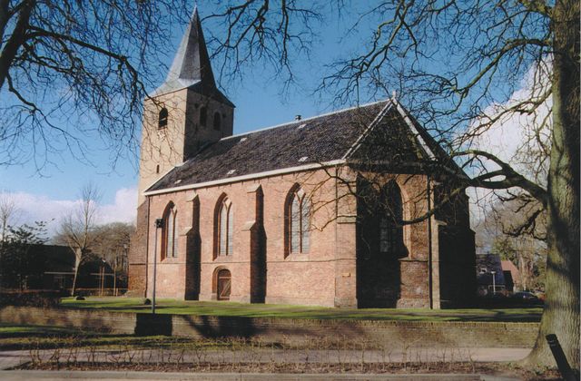
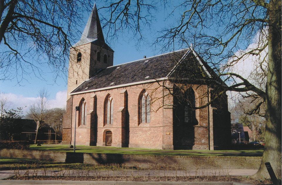
    First mentioned in ancient writings in 1206, Westerbork is the departure point of this signposted route. Later converted into a church in 1283, Westerbork already had a chapel at the time. The current Westerbork has a charming touristic centre where you can relax on a terrace or visit one of its two museums. Westerbork also became well known for Camp Westerbork, which was used as a transit camp by the Germans during the Second World War. However, Westerbork Memorial Centre and the former camp are twelve kilometres removed from Westerbork by the edge of Hooghalen.

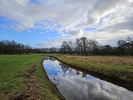
    Walk through ancient landscapes outside of Westerbork. The second-to-last ice age had a tremendous influence on the landscape here, shaping the Drents Plateau. Farmers settled on these “Drenthe Highlands,” creating the area’s characteristic esdorp landscape of high-lying villages with brinken (a brink is a central open space to be found in many of Drenthe’s sandy settlements) and essen (high-lying farmlands), hedgerows and low-lying grazing and hay meadows in the catchment area of the stream (Westerborkerstroom).

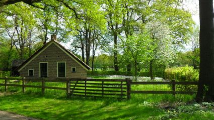
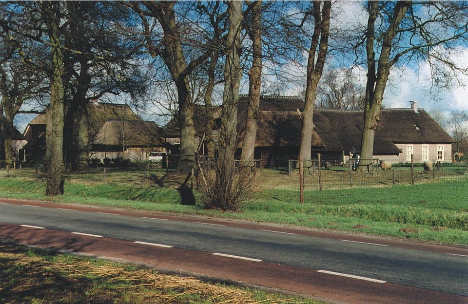
    In the originally medieval esdorp of Zwiggelte, you can taste the authentic atmosphere of Drenthe in olden times. Zwiggelte’s open character has largely remained intact. Along the south-eastern side of the village, lies a remnant of a brink with old oaks and beautiful Saxon farms.

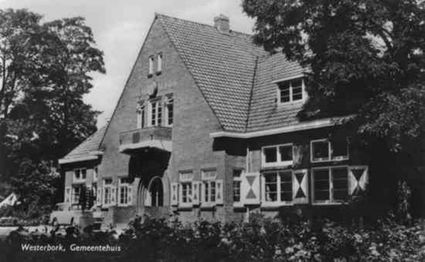
    The route starts at Hoofdstraat 16 by ’t Aole Gemientehoes, Westerbork’s former village hall. You can park for free behind the centre. You can also use the signposting present to start the route from other locations.

    Sights on this route

    Starting point: Hoofdstraat 16
    9431 AD Westerbork
    1

    2

    3

    4

    5

    6

    End point: Hoofdstraat 16
    9431 AD Westerbork

    Directions

    Starting point: Hoofdstraat 16
    9431 AD Westerbork
    • The route starts at Hoofdstraat 16 by ’t Aole Gemientehoes, Westerbork’s former village hall. In 1927 this village hall and the caretaker’s house were constructed in the characteristic Interbellum architectural style, based on a design by architect J. Boelens from Assen. Today the building is used by home care provider ‘t Derkshoes.
    • Today, Westerbork’s past as a farmers’ village is revealed by the stylish farms along Hoofdstraat and Burgemeester G. van Weezelplein.
    • The Stephanus Church at Hoofdstraat 10 is a Gothic church. In 1206 there used to be a chapel called Burch, which was part of the church in Beilen. Westerbork’s current church was built in the 15th century as a replacement of its wooden predecessor. Dating back to the 13th century, the bottom part of the tower is much older. The upper part of the tower was constructed much later in 1778. The church was dedicated to the martyr Stephanus. After the church’s transference to the Protestants in 1600, this name was forgotten. The church was officially renamed the Stephanus Church in 2007. After the church, take a left and leave the village through a street with old buildings, reconstructed farms, a patch of forest and an older, new housing estate.
    • Passing Westerborkerstroom, take a right to walk alongside this stream. The second-to-last ice age had a tremendous impact on the landscape here. The glaciers transported huge quantities of sand, clay and boulders from other regions. In the centre of Drenthe at Beilerdingspel, a ground moraine of boulder clay remained, forming the so-called Drents Plateau. The flowing water of the retreating and melting ice caused the landscape to erode. This is how the stream valley of the Westerborkerstroom developed. Farmers settled on these “Drenthe Highlands,” creating the area’s characteristic esdorp landscape of high-lying villages with brinken (a brink is a central open space to be found in many of Drenthe’s sandy settlements) and essen (high-lying farmlands), hedgerows and low-lying grazing and hay meadows in the catchment area of the stream (Westerborkerstroom).
    • The walk takes you through the esdorp Zwiggelte. Despite Zwiggelte’s (limited) expansion, its open character has remained intact. Along the south-eastern side of the village, lies a remnant of a brink with old oaks and beautiful Saxon farms. There are several noteworthy specimens along, among other places, Hoofdstraat: 18th- and 19th-century Low German houses with large back doors or long middle part. Walking out of the village, you pass old oaks and Saxon farms.
    • The route takes you back to Westerbork. En route, you pass Westerborkstroom again. In and out of Westerbork’s new housing estate for a last view of the area’s attractive green landscape. Then, back into Westerbork. Here, at the edge of the built-up area, lies Het Schepershuisje (“The Shepherd’s Hut”) at Pieterbergweg 24. This house originated around 1880 as a sod house close to Westerbork’s sheepfold. In 1919 it was equipped with a stone wall. The small house was inhabited by scheper (shepherd) Noordhuis and his brother until 1981. Now property of Foundation Het Drentse Landschap, Het Schepershuisje can be rented as a holiday home.
    • Museum Restaurant De Ar at Hoofdstraat 42 in Westerbork is also well worth a visit. You can enjoy a 50-year-old private collection there, including a Groningen grocery, a traditional Drenthe room with bed boxes and peat-burning stone, a room decorated in traditional Gelderland style, a complete gentleman’s hairdressing salon, a South Holland cheese maker from 1800 and beautiful old children’s toys.
    • Another option is the Museum van Papierknipkunst (“museum of paper-cutting art”). G. van Weezelplein 10. The museum displays many national and international paper-cutting works of art across a range of topics. You can also try your own hand at paper cutting in the museum. A cutter will demonstrate how to do the cutting and challenge you to try for yourself.
    End point: Hoofdstraat 16
    9431 AD Westerbork