Hunze

(48.0 km)

  • Download
  • The 48-kilometre ‘Hunze’ cycling route takes you along the Semslinie, the provincial bor…

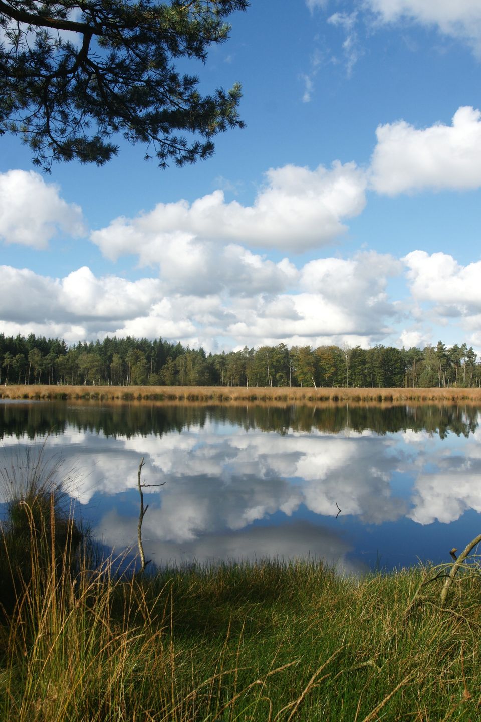
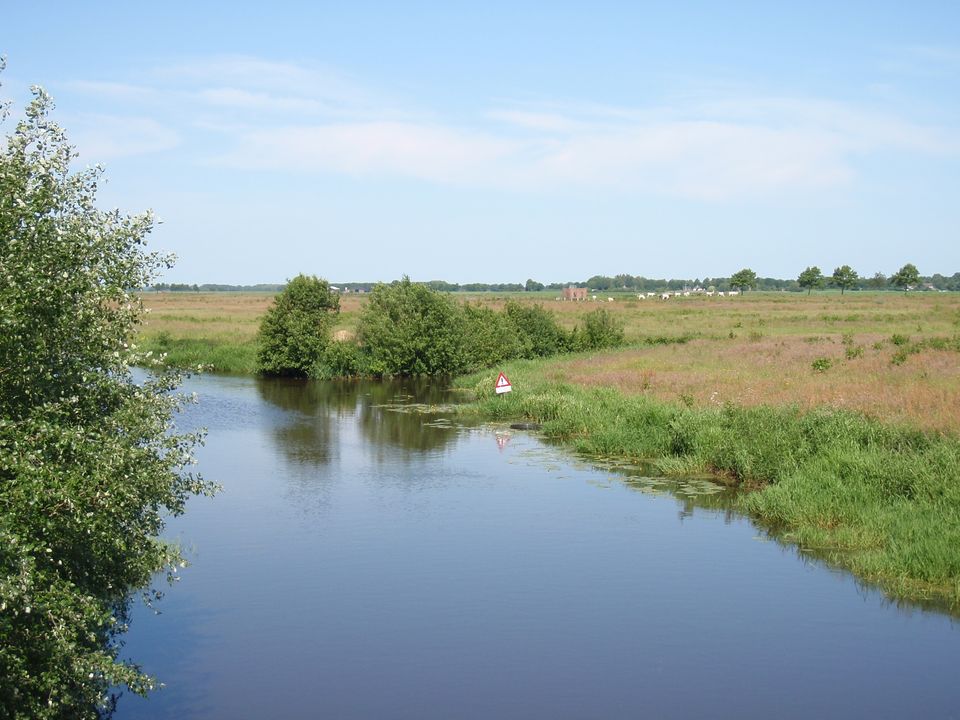
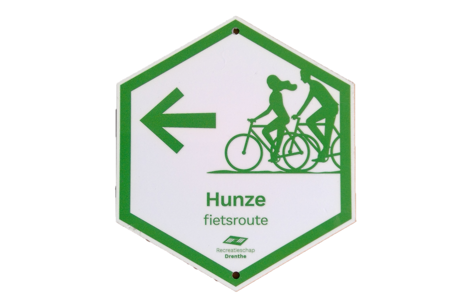
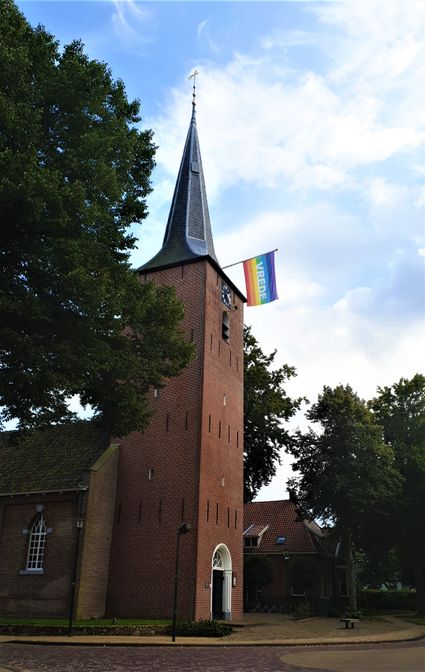
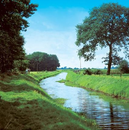
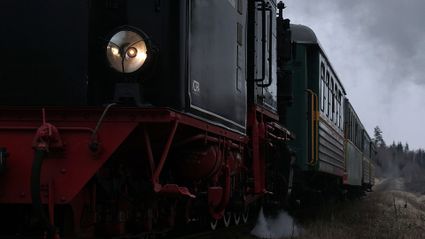
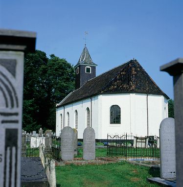
    The 48-kilometre ‘Hunze’ cycling route takes you along the Semslinie, the provincial border between Groningen and Drenthe. The route starts in Gieten in Drenthe and leads past burial mounds, through small villages, past a small church and a corn mill towards the Hunze valley. The viewpoint here is a great place to stop and take in the natural beauty of your surroundings. Moments later, you will arrive in the village of Stadskanaal in Groningen, where you can marvel at the stunning restored trains at Museum Railway S.T.A.R., the longest railway museum in the Netherlands.

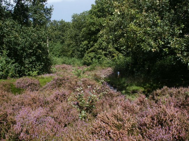
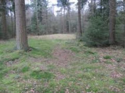
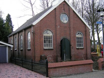
    Back in Drenthe, the route takes you past the Drouwenerzand with its forests and heathlands, and through forestry area Gieten-Borger. Dolmens D19 and D20 near Drouwen will make you feel as though you have gone back in time.

    The cycling route starts at the car park at the Brink, near Brink 7, 9461 AR Gieten (Hub point 20). There is plenty of free parking available. It is also possible to join the route at other locations by following the signs.

    Sights on this route

    20
    1

    50
    59
    2

    47
    26
    3

    35
    34
    15
    4

    5

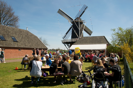
    Grain mill De Eendracht in Gieterveen is beautifully located by the edge of the village. There are houses on one side and expansive landscapes on the other. The mill is still in operation, milling the region’s grain. Its team of volunteers is responsible
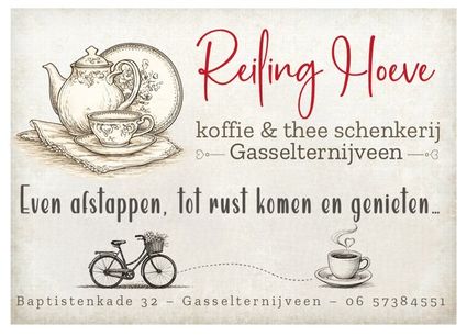
    Eendracht
    16
    48
    25
    6

    58
    56
    57
    01
    7

    freshly ground coffee - friendly - cozy terrace - homemade small-scale - regional product - 40 flavors of loose tea - nostalgia

    Reiling Hoeve - koffie en thee schenkerij
    8

    9

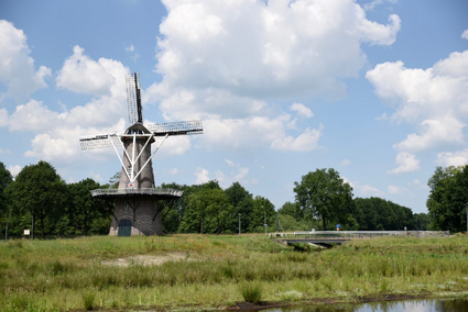
    De Juffer is a mill that lies just outside the village of Gasselternijveen. Standing atop the mill’s stage, you can enjoy beautiful views of recovered brook-rich area Oude Weer, which was installed in 2014. The millers will gladly show you around. They a

    De Juffer
    08
    02
    10

    61
    55
    52
    51
    20

    Directions

    20
    • The cycling route starts at the Brink in Gieten. Gieten is first mentioned in 1221, but is thought to be much older because of the burial mounds in the Zwanemeerbos to the north of Gieten. The church was built in the 15th century and its rather unmedieval character can be attributed to alterations carried out around 1850. Adjacent to the church is the former Braams hotel, first built as an inn in 1617 on the medieval Groningen-Coevorden route. Part of this route still exists; it is now the sandy lane that runs through the Zwanemeerbos. ‘De Hazewind’ mill was built in 1833.
    • The route now takes you away from Gieten, towards Eexterzandvoort and past several burial mounds. After Eexterzandvoort, you will pass the small river Hunze, also called Oostermoerse Vaart. The Hunze springs as Achterste Diep in the Exloosche Landen and the Exloosche Monden and as Voorste Diep as it winds its way through the Hondsrug near Borger, towards the Eeservenen. The Hunze is situated in the valley between the Hondsrug to the west and a low sandy ridge to the east. This low sandy ridge ensured that the former Bourtangermoor stopped short of the Hondsrug. The Hunze flows into the Zuidlaardermeer and continues as Drentsche Diep, on to the Winschoter Diep. The Hunze valley developed during the Ice Age. Midway through the 18th century, the Hunze became a significant lifeline for peat shipping. The Hunze was passable up to Gasselternijveen. The river was canalised during the 1960s to enable regulated drainage for farming. Because the Hunze gets the majority of its water from seepage, this regulation did not work properly. Large parts of the river basin, spread across various locations such as the Elzenmaat, have since been returned to Mother Nature by digging out the old meanders once more.
    • The viewpoint Elzemaat is situated in the centre of the Hunze valley; the building in the Elzemaat was erected halfway through the last century for the purpose of pumping clean water to the potato factory three miles further along. Now that the building is no longer in use, the Drentse Landschap foundation has breathed new life into the structure by converting it into a viewpoint.
    • The route takes you to Gieterveen. The small church is the first thing you see when entering the village. Further along, corn mill De Eendracht towers above the houses. This mill originally stood in Nieuw-Buinen and was moved to Gieterveen in 1877. The current circular top part of the building was added after a fire.
    • The route takes to the border between the provinces of Groningen and Drenthe, along the Semslinie. The word Semslinie might evoke initial thoughts of a defensive structure from olden days. It is true that it’s old, but it has nothing to do with defence. The conflicts between landowners from Drenthe and Groningen peaked in 1614. According to people from Drenthe the monastery in ter Apel belonged to Drenthe, but the people from Groningen disagreed. Johan Sems, a Frisian surveyor was called upon to determine a border and resolve the conflict. He drew the borderline in a virtually straight line between Huis Ter Haar (north of Ter Apel) and the Martini tower in Groningen. This did not quell the conflict, as those from Groningen refused to hand over the monastery to Drenthe. The arrival of the Stadskanaal created a definitive border, meaning the monastery remained in Groningen. A small section of the Semslinie is a recognised provincial border.
    • The Semslinie takes you to Museum Railway S.T.A.R. in Stadskanaal. The Museumspoorlijn S.T.A.R. is the longest railway museum in the Netherlands. Since 1995, the track has been running from Veendam to Musselkanaal. The Museumspoorlijn follows the Semslinie in parts. The Noordoosterlocaalspoorweg-Maatschappij (NOLS, North-Eastern Local Railway) laid the Assen-Gieten-Stadskanaal route in 1905 (now converted to a footpath) and the Veendam-Stadskanaal route in 1910. The original S.T.A.R. (Groningsch-Drentsche Spoorwegmaatschappij Stadskanaal-ter Apel-Rijksgrens, Groningen-Drenthe Railway Company City Channel at Apel Border) laid the Stadskanaal-Musselkanaal route in 1924.
    • The route now takes you to Gasselternijveen. Although the name Gasselternijveen only appears on maps in French times, Gasselternijveen is considered the oldest peat colony in the Hunze area. The Hunze was passable back the 17th century when the Stadskanaal did not exist yet. From Gasselternijveen, so-called mouths were excavated and these were used to excavate canals and weirs through the peatland. The States General decided in 1667 that there would be free passage on the Hunze, which resulted in Gasselternijveen developing into a sailor’s village. These sailors transported peat to Groningen, and even to the rest of the Netherlands until eventually, they even sailed coasters to Scandinavian countries and England. As all these sailors were based in Gasselternijveen, the village flourished between 1840 and 1930. In 1913, Gasselternijveen was the fourth largest seaport in the Netherlands in terms of number of ships, after Rotterdam, Amsterdam and Groningen. The shipping industry here declined after 1930.
    • After Gasselternijveen, the cycling route leads you to Gasselte with its Witte Kerkje (‘Little White Church’), thought to hail from the second half of the 13th century. The church in Borger is the parent church. Drouwenerzand is a vast area of forest and heathland to the south of Gasselte. The area is home to a sand drift area. Throughout history every effort was made to kerb the sand drifts, but now conservation is aimed at maintaining the sand drifts. The juniper tree is a striking part of the heathlands. From a national aspect, the juniper tree only makes a rare appearance, but this tree is quite common in Drenthe. It is probably common knowledge that the berries are used for making an alcoholic drink... you guessed it: gin (jenever).
    • The route runs through forestry area Gieten-Borger and back towards Gieten. The trees in the forestry area were planted for logging during the last century. Small ponds and heath clearings hide among the trees. Many roads are paved using cobbles from Drenthe, unearthed during extraction. The Anderensche Diep river valley is to the west, with its magnificent grasslands and old hedgerows. The forestry area features two ‘hemelrijken’ (celestial bodies). 't Olde Hemelriek is a stunning natural pond and 't Nije Hemelriek is a manmade leisure pond with beach.
    • The ‘Hunzeroute’ cycling route finishes here. Recharge your batteries in a local cafe or restaurant to reflect on this amazing cycling trip.
    20
    • 20
    • 50
    • 59
    • 47
    • 26
    • 35
    • 34
    • 15
    • 16
    • 48
    • 25
    • 58
    • 56
    • 57
    • 01
    • 08
    • 02
    • 61
    • 55
    • 52
    • 51
    • 20