
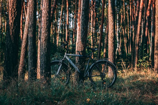


E-bike route
Racing
61 km
Drenthe Periphery Route 5 starts and ends at the Monierweg/Edisonstraat roundabout in Coevorden. The route has a length of 61 km and passes through Schoonebeek, Nieuw-Schoonebeek, Weiteveen, Barger-Oosterveld, Klazienaveen, Nieuw-Amsterdam, Veenoord, Wachtum and Dalen—and back again to Coevorden.
Coevorden
Coevorden is home to many historic buildings; most of them from just after 1592. In that year, Prince M…
Drenthe Periphery Route 5 starts and ends at the Monierweg/Edisonstraat roundabout in Coevorden. The route has a length of 61 km and passes through Schoonebeek, Nieuw-Schoonebeek, Weiteveen, Barger-Oosterveld, Klazienaveen, Nieuw-Amsterdam, Veenoord, Wachtum and Dalen—and back again to Coevorden.
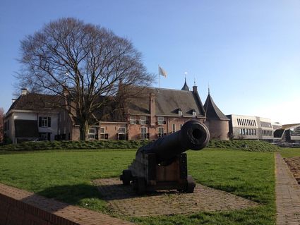
Coevorden
Coevorden is home to many historic buildings; most of them from just after 1592. In that year, Prince Maurits freed the city from the Spaniards, who had spent eleven years laying siege to it. Sadly, the departing Spaniards set fire to the entire city, causing almost all buildings from before that time to be destroyed. A part of the historic centre from after this time has remained intact ever since, and has been spectacularly enhanced with matching new buildings. The most impressive structure on the market is theatre De Hofpoort, which also functions as the town hall. Behind it you find a walking bridge towards Coevorden castle, which now serves as a hotel restaurant. The castle dates back to the 11th century but was also rebuilt in the 16th century.
Jaknikkers (pumpjacks) in Schoonebeek
Schoonebeek is home to the second-largest oil field of Western Europe’s mainland, which is why there are so many jaknikkers here. These jaknikkers were used to extract oil until 1996. The centre of Schoonebeek has the most special jaknikker, which is also a listed national heritage. Although it no longer extracts oil, it still runs during the day.
Starting points with parking options
There are multiple starting points for the route where you can park your car. This allows you to start the route from wherever you like.
Coevorden: Car park EDS Plein, car park Sportlaan (100 m)
Schoonebeek: Car park Burg. Osselaan
Weiteveen: Car park Veltmanlaan
Klazienaveen: Car park Dordsebrug, car park Van Echtenskanaal NZ (100 m), car park Evenaar (100 m)
Erica: Car park Havenstraat
Nieuw-Amsterdam: Car park Vaart ZZ
Dalen: Car park Wettringerlaan
Part of Drenthe Periphery 255 km
This route is part of the route Drenthe Periphery 255 km, that runs along the border of the province of Drenthe. Within this long route, you can also pick and choose from among ten shorter routes—varying from 55 to 67 kilometres—or two routes of 135 and 170 kilometres.
The Weiteveen Peatland Trekking Centre is a private initiative of villagers to offer guided peat tours in the Bargerveen Nature reserve.
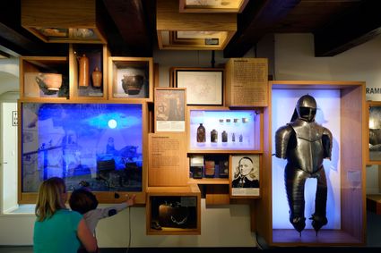
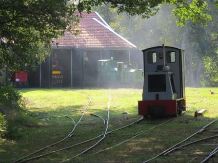
Located in Erica in The Netherlands, the ‘Industrieel Smalspoor Museum’ (Museum of the Industrial Narrow-gauge Heritage Railways) tells the story of the narrow-gauge railways
He must have spent hours sitting in the stuffy deckhouse. From the dry and warm ship’s cabin, he would have looked through the small portholes and have seen the dark surroundings slowly pass by.
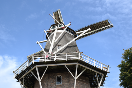
This grain mill and huller (a type of mill used to remove the hulls off rice grains) is a museum. This tall mill runs regularly, and is therefore open several days a week. Jan Pol is Drenthe’s highest mill, and used to be an iconic element of the village
Legend route description:
CR = crossroad
TL = turn left
KL = keep left
to. = towards
TJ = T junction
TR = turn right
KR = keep right
le. = left
ROU = roundabout
SA = straight ahead
CSA = continue straight ahead
ri. = right
TrL = traffic light