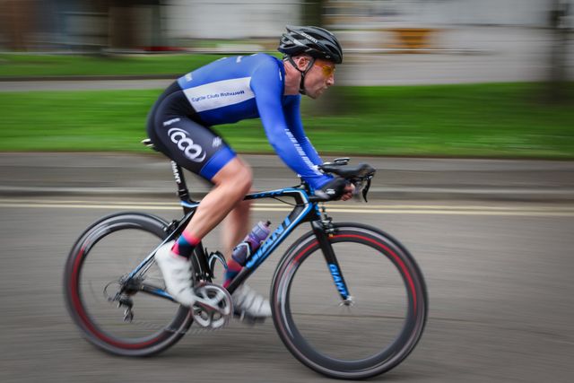


E-bike route
Racing
56 km
Drenthe Periphery Route 9 Roden starts and ends at Brink in Roden. The route has a length of 56 km and passes through Steenbergen, Norg, Zeijen, Tynaarlo, Vries, Donderen, De Punt, Eelde and Peize—and back again to Roden.
Brinkdorpen
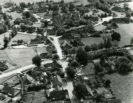
On this route, you pass through no fewer than five brinkdorpen: Roden, Norg, Zeijen, Tynaarlo and Vries.
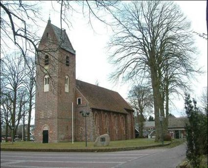
Brinkdorpen were built in medieval times—often atop a sandy ridge to remain dry. Each village had one or more squares; its brink. This was the centre of the village, around which houses and farms were built.
A lot of things went on on the brink. You would often find a dobbe, a deep hole filled with water, there. This water was used as drinking water for livestock, but also to wash clothes or extinguish fires. In the morning, livestock was gathered on the brink to…
Drenthe Periphery Route 9 Roden starts and ends at Brink in Roden. The route has a length of 56 km and passes through Steenbergen, Norg, Zeijen, Tynaarlo, Vries, Donderen, De Punt, Eelde and Peize—and back again to Roden.
Brinkdorpen
On this route, you pass through no fewer than five brinkdorpen: Roden, Norg, Zeijen, Tynaarlo and Vries.
Brinkdorpen were built in medieval times—often atop a sandy ridge to remain dry. Each village had one or more squares; its brink. This was the centre of the village, around which houses and farms were built.
A lot of things went on on the brink. You would often find a dobbe, a deep hole filled with water, there. This water was used as drinking water for livestock, but also to wash clothes or extinguish fires. In the morning, livestock was gathered on the brink to graze outside of the village; they would return in the evening, after which the farmers would pick up their own animals.
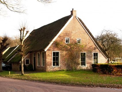
Right next to the village lay a large piece of land, the es (an area of high-lying farmland). Each farmer had his own small piece of farmland on this es, on which he would cultivate rye, barley, oats or potatoes. Surrounding the es were hedgerows. These ensured deer, wild boards and rabbits couldn’t eat or trample the crops. Behind the hedgerows, there would be forest. This is where the farmers chopped the wood they used as fuel or to repair their houses and tools.
The brinkdorpen often have many remnants from the past: old farms, dirt tracks, the brink, the es and sometimes a dobbe.
Starting points with parking options
There are multiple starting points for the route where you can park your car. This allows you to start the route from wherever you like.
Roden: Car park De Brink
Norg: Oosteind
Tynaarlo: Dorpsstraat/carpool location
Vries: Kornoeljeplein (town hall)
De Punt: Groningerstraat
Peize: Sports hall Peize (Hereweg)
Part of Drenthe Periphery 255 km
This route is part of the route Drenthe Periphery 255 km, that runs along the border of the province of Drenthe. Within this long route, you can also pick and choose from among ten shorter routes—varying from 55 to 67 kilometres—or two routes of 135 and 170 kilometres.
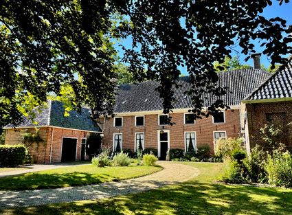
Museum Havezate Mensinge – Step into history In the heart of Roden lies the most authentically furnished manor house in the Netherlands. With its original furniture, artworks, and personal objects, the house tells centuries-old stories of noble families and their remarkable lives.
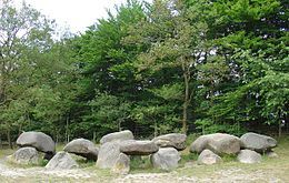
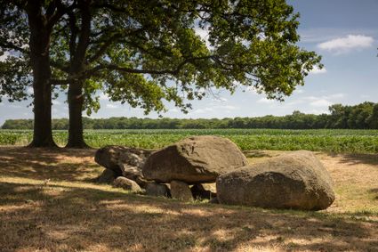
Dolmen D1 is the most northern dolmen of Drenthe, located in the small town of Steenbergen. Steenbergen was used in the past as a ‘drentse’ term for a dolmen and the name of the place Steenbergen is probably derived from the dolmen that’s there.
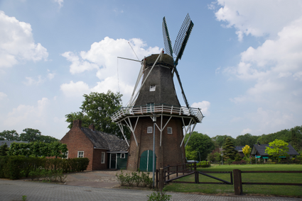
Noordenveld mill is one of two mills in the village of Norg. Two functioning mills in one village! The mills take turns running on Saturdays. Noordenveld is privately owned—but its owner gives millers plenty of opportunity to keep it running. The mill
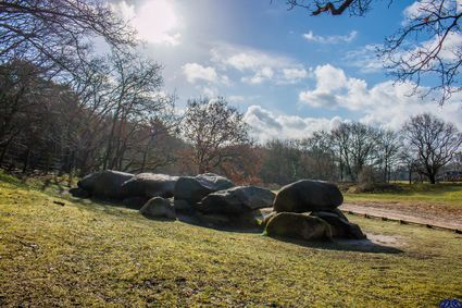
Opposite of the nature park “Zeijer Strubben”, about a 100 meters to the right from the road Zeijen-Peest, lies the dolmen D5 (Drenthe 5). The dolmen is barely visible from the road, because it’s lying in a pit. Only four of the coping stones are visible.
Start: De Brink in Roden
From De Brink to. Norg (Brink) - after 2 km to. Roderesch
Roderesch
CSA to. Steenbergen (Hoofdweg)
Steenbergen
T junction KR to. Een
Een
Rou TL to. Norg (Eenerstraat)
Norg
End of the road TR to. Assen (Westeind) - 2nd road TL to. Vries (Brink) - 3rd road TR to. Peest (Peesterstraat)
Peest
CSA to. Zeijen (Hoofdweg/Peesterweg)
Zeijen
T junction TL to. Ubbena (Ubbenaseweg/Zeijerstroeten) - CR SA to. Taarloo (Oudemolenseweg) - after tunnel 1st road TR (Taarlooseweg) - bridge Noord Willemskanaal - after bridge 1st road TL to. Zeegse (Buitenstrengen) - CR SA (Eisenbroeken)
Tynaarlo
End of the road TL (Schoolstraat) - end of the road TL (Dorpsstraat) - CSA to. Vries - 3x ROU SA (Vriezerweg) - after bridge (Tynaarloseweg)
Vries
End of the road TR (Nieuwe Rijksweg) - 1st road TL (Oude Rijksweg) - T junction TR (Schultestraat) - CSA (Molenstraat/Eswal/Noordenveldweg)
Donderen
CSA (Vriezerweg) - end of the road TR (Norgerweg) - ROU SA to. Yde (Norgerweg)
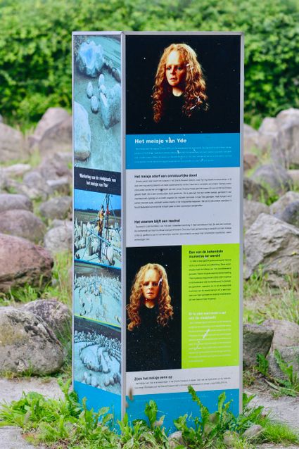
Yde
CSA to. De Punt
De Punt
End of the road TL (Groninger Straatweg) - ROU TL to. Eelde
Eelde
Paterswolde
After ROU Meerweg TL to. Peize (Boterdijk) - CSA to. Peize (Verlengde Boterdijk/Noorddijk)
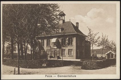
Peize
1st road TR (Brusselseweg) - 1st road TL (Boerakkerweg/De Woert) - end of the road TR (Hoofdstraat) - end of the road TL to. Roden (Roderweg) - at TrL oversteken and TL to. Roden - at TrL TL to. Roden (Oosteinde)
Roden
ROU TL to. Norg
Finish: Brink in Roden
Legend route description:
CR = crossroad
TL = turn left
KL = keep left
to. = towards
TJ = T junction
TR = turn right
KR = keep right
le. = left
ROU = roundabout
SA = straight ahead
CSA = continue straight ahead
ri. = right
TrL = traffic light